The Beartooth Highway is a scenic mountain road in Montana and Wyoming that provides breathtaking wilderness views. It is located east of Yellowstone National park’s Northeast Entrance between Red Lodge, Montana, and Cooke City, Montana.
The Beartooth Highway(US-212) is usually open from Memorial Day to early October, depending on weather conditions, so it is best to check the road conditions before your visit. The drive is about 68 miles (109 km) long and takes 2-3 hours to complete.
Here are some highlights of the highway:
Scenery
The Beartooth Highway offers some of the most spectacular mountain scenery in the United States, with stunning views of peaks, valleys, lakes, and glaciers.


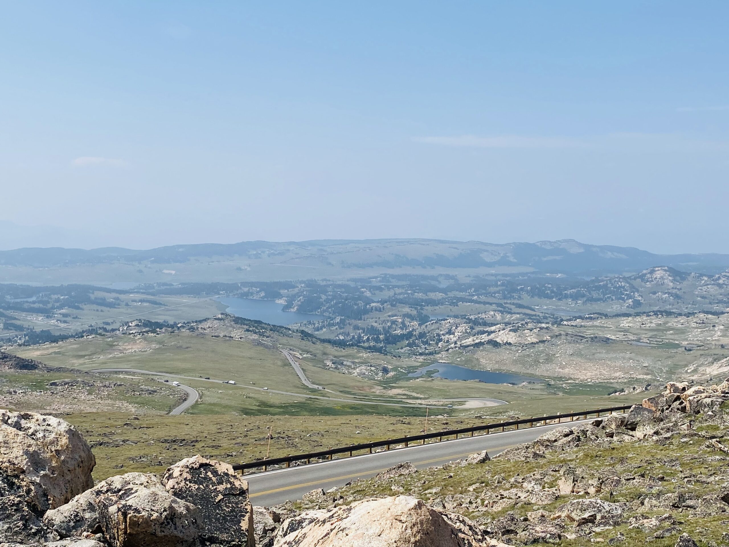
Beartooth Pass Summit
With an elevation of 10,947 feet, West Summit is the highest point along the Beartooth Highway.

You can enjoy breathtaking views of the mountains, glaciers, and alpine lakes from the summit. The road leading up to the summit is a feat of engineering, with switchbacks, steep grades, and hairpin turns.

Hiking
The Beartooth Highway provides access to several recreational opportunities, including hiking, fishing, and camping in the surrounding wilderness.

Gardner Lake Trail is a 1.6-mile out-and-back moderate trail near Red Lodge, Montana. It provides breathtaking views on the way down the hill.

Beartooth Basin Summer Ski Area
It was windy at the top, and we saw glaciers in mid-summer, providing breathtaking views.


Vista Point Observation Point
Vista Point is a popular stopping point along the Beartooth Scenic Highway. A short hard surface trail leads to a platform overlooking Rock Creek Valley, where you can enjoy spectacular views and various interpretive displays.


Our Experience
We drove on the Beartooth Highway on our road trip from Yellowstone National Park to Devils Tower Monument. We exit Yellowstone National park from the NorthEast entrance, driving Beartooth Highway, stopping at different observation points, and continuing towards Gillette, where we stayed the night before visiting Devils Tower the next day. We also visited Little Bighorn Battlefield on the way there.
Additional Stops
Little Bighorn Battlefield National Monument
The Little Bighorn Battlefield National Monument, also known as Custer’s Last Stand, is a historic site in Montana that marks the site of the Battle of Little Bighorn, a significant battle in the Great Sioux War of 1876.

Things to do
1. Explore the Visitor Center, Museum, and Bookstore
2. Visit the Indian Memorial and the 7th Cavalry Monument at Last Stand Hill, a.k.a. “Custer’s Last Stand.”
3. Walk the 1/4 mile Deep Ravine trail.
4. Drive the 4.5-mile Battlefield tour road to the Reno-Benteen Memorial. Along the route, there are waysides where you can pull over to read.
5. Walk through Custer National Cemetery.
6. Guided tours and Rangers talks are available from Memorial Day till Labor Day.
The Little Bighorn Battlefield National Monument is open year-round, with extended hours during the summer months. The entrance fee is $25 per vehicle or free with an America the Beautiful Pass. You can spend about 2-3 hours exploring the site.
On this trip, we also visited Custer State Park, named after Custer, and Crazy Horse Memorial, which is in memory of Sioux Leader Crazy horse. We learned more about Custer, his men, and the Indians on this trip by visiting these three places.